
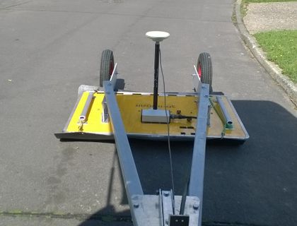
GPR provides quick, precise and in depth information along every centimeter of the road
The evaluation of the base and sub-base levels, the thickness of the asphalt and gravel layers, along newly constructed, reconstructed or old roads are parameters that indicate road surface distress due to load and friction. It is also a solid indicator of the remaining life of the road.
The possibility of continuous linear data collection and full coverage of road structure is reducing the need of coring. Drill core methods only provide specific point information and therefore they cannot reliably be used to find defective areas in roads and pavements.

-
GPR Road Mapping
-
Road Layer and Structure Analysis
-
High Density Multi Channel GPR
-
3D-Radar GPR
Data provided with GPR will help in the assessment of any road reconstruction and confirm the properly kept standards during road constructions.
Main advantages:
- Fast and continuous linear data collection (can be performed from moving vehicle)
- Not destructive as traditional core drillings
- Accurate results for different layers
- Safe, precise and low cost service for all road networks
- GPS intergraded